The Back Roads That Shaped Me
Always full of wonder, Mom and Dad made sure that I—and my brothers and sisters—saw as much of our beautiful country as possible. Well, at least the eastern half. Limited to a ten-day vacation in a travel trailer each summer, they carefully planned how far Dad could reasonably drive from Atlanta in five days—and still make it home again.
By the time I was on my own, I had visited every state east of the Mississippi, along with several out west. Over the years, that number has grown to forty-five states and thirty-one National Parks. And to this day, my favorite way to travel long distances is still the same: take the back roads. The expressways are great for getting somewhere fast—but if you want to get to know the people, the places, and the culture, take the blue roads.
Lessons from Places That Were Almost Lost
It’s been years since I last watched The National Parks: America’s Best Idea or read the accompanying book, but a few moments from that story have never left me. By the late 1800s, Niagara Falls—one of the natural wonders of the world—had already been overtaken by industry and commercialization, its beauty crowded and controlled. It became an early reminder that even the most extraordinary landscapes are not immune to being diminished when protection comes too late.
A generation later, standing at the edge of the Grand Canyon, Theodore Roosevelt saw clearly what was at stake. “Leave it as it is,” he urged. “You cannot improve on it… the ages have been at work on it, and man can only mar it.” With the influence of voices like John Muir and the leadership of men such as Stephen Mather, that idea took root—not just as philosophy, but as action—leading to the protection of places that might otherwise have been altered beyond recognition.
A Familiar View, Then and Now
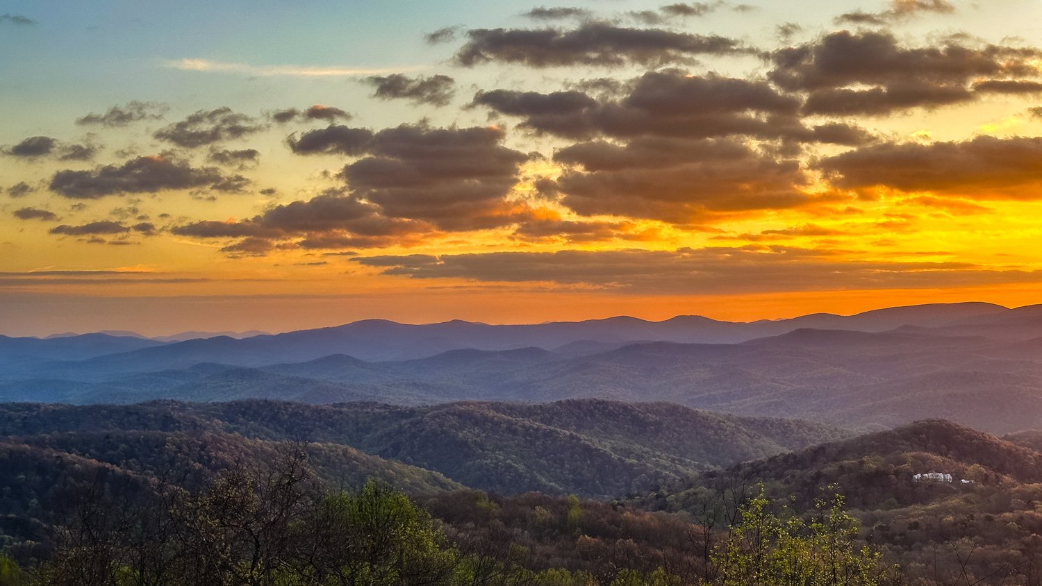
Those ideas—formed decades earlier—would come back to me years later in the mountains of North Carolina. And again, years later, while sipping iced tea on my back deck, looking out toward Amicalola Falls State Park in the distance.
Many of you reading this may have stood inside the lodge at Amicalola Falls and walked toward those enormous windows—pausing as the view opens up in front of you. In the spring and summer, when the mountains are green, it’s difficult to spot a single structure anywhere in the vast panorama. In the fall, when the ridges are ablaze in color, people step out onto the veranda and quite literally catch their breath.
That’s how I first experienced the mountains of western North Carolina when I arrived at Appalachian State in the early 1980s.
Howard Knob
Drawn by my love of the mountains, I rented a small house halfway up Howard Knob, overlooking Boone. From my deck, I could see for miles—and even then, I appreciated the unspoiled beauty.
But trouble had already begun. A few years earlier, as part of a federal alternative energy demonstration project, Appalachian State had installed a massive wind turbine at the summit. Nearly 100 feet tall, it could be seen from all over Boone. The ridgeline—once clean and uninterrupted—had been, in Roosevelt’s words, marred.
Locals didn’t care for it. It was loud. It interfered with television reception. And most of all, it simply didn’t belong. After just a few years, it was removed.
At the time, it felt like an isolated decision. In hindsight, it was something else entirely—a warning.
The Calm Before the Storm
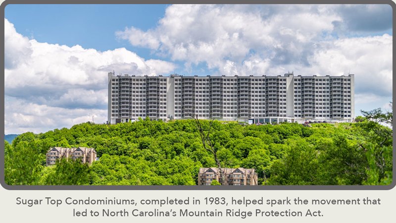
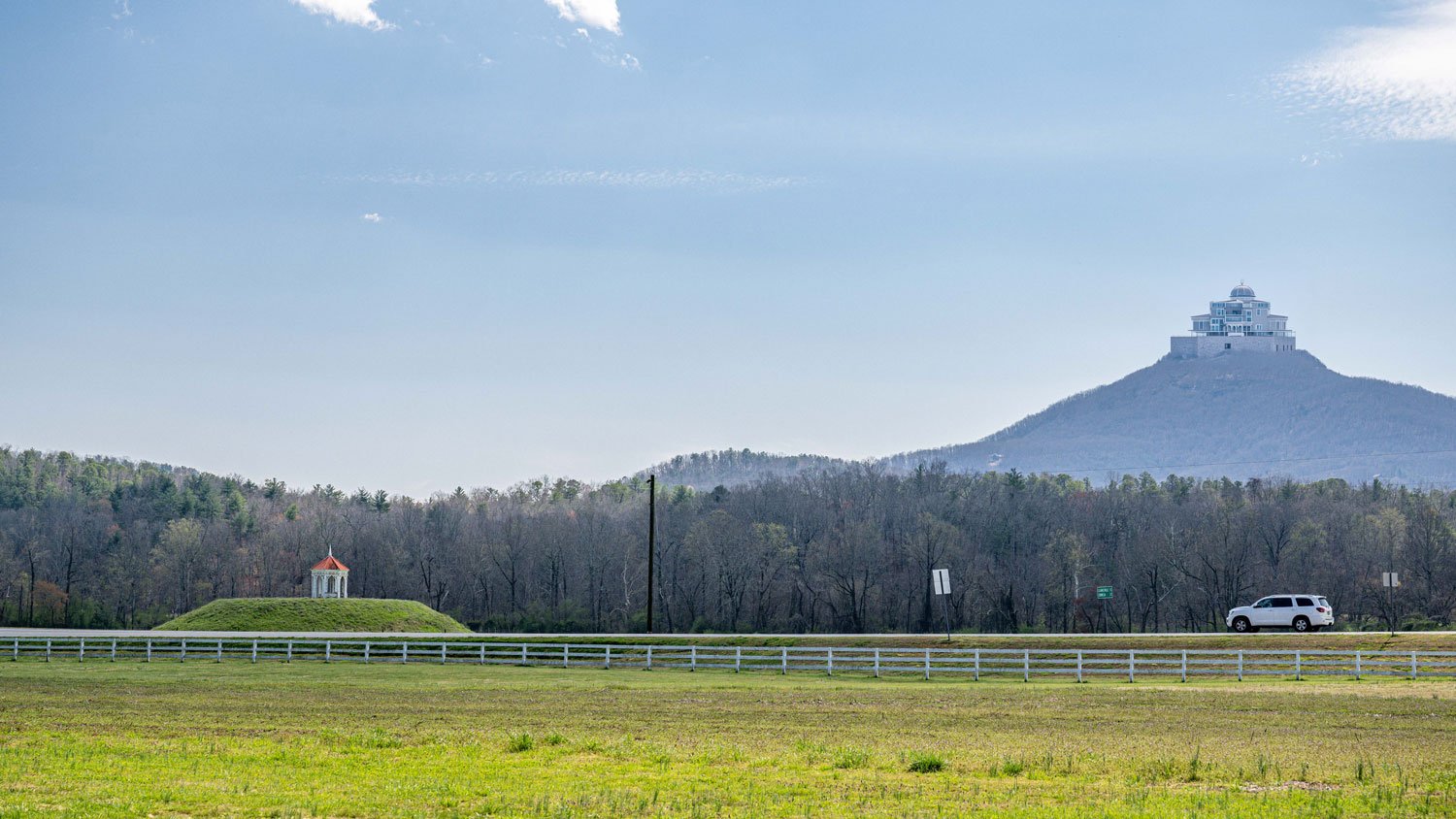
Sugar Top Condominiums, completed in 1983, helped spark the movement that led to North Carolina’s Mountain Ridge Protection Act.
The wind turbine was only the beginning.
Just down the road in Banner Elk, ten acres atop Little Sugar Mountain were sold in the early 1980s to a developer with far bigger plans. What some assumed would be a modest structure quickly grew—first to five stories, then to ten.
Blasting began near the 5,000-foot summit. There were no laws preventing it. And nothing—other than the difficulty of building at that elevation—stood in the way.
“Everybody Who Is Rich…”
Almost immediately, opposition began to build.
Hugh Morton, one of the most influential figures in High Country development, understood what was coming. He had spent years promoting the region, but he also understood the consequences of overbuilding its most visible places.
“If Sugar Top is successful financially,” he warned in 1983, “there will be a rush to build more before anything can be done to stop it.”
His concern wasn’t hypothetical. By early 1983, most of the units had already sold—many to out-of-state buyers seeking cool summers and sweeping views.
The developer said it plainly:
“The public desires a view. Everybody who is rich desires to be on top of a mountain. Period.”
Click any image to enlarge—they reveal more than first meets the eye
-

From the lodge at Amicalola Falls State Park—where visitors pause at the windows and take in a view that felt untouched.
-

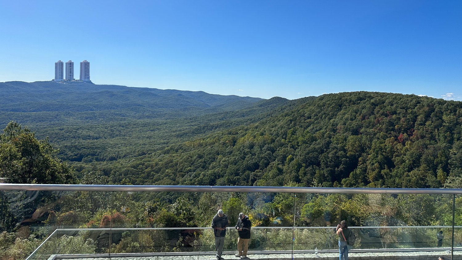
From the summit of Brasstown Bald, Georgia’s highest point—layered ridgelines stretching to the horizon, formerly uninterrupted and timeless.
-

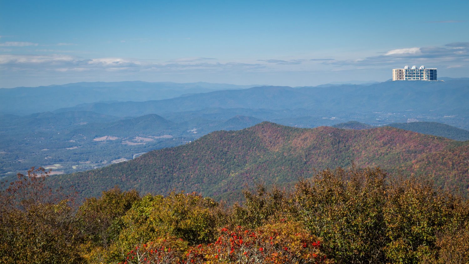
Hardman Farm below—quiet and timeless. Above it, a structure that changes the view for everyone.
When the Mountains Fought Back
What happened next was both swift and remarkable. Residents across western North Carolina—many of whom had never before been politically active—came together almost overnight. Local leaders, conservationists, business owners, and everyday citizens formed a loose but determined coalition, united by a shared concern: if this could happen once, it would happen again. Public meetings were held. Editorials were written. Pressure mounted in Raleigh. Within a remarkably short time, the movement had gained enough traction that lawmakers responded. In 1983, the Mountain Ridge Protection Act was passed, drawing a line—literally and figuratively—at the ridgeline.
What the Law Says
The Mountain Ridge Protection Act applies to development on ridge tops above 3,000 feet in elevation that rise at least 500 feet above the surrounding terrain. It limits the height of structures to 40 feet and restricts construction on protected ridgelines.
It doesn’t prohibit development—but it ensures that the skyline remains intact.
Georgia Needs a Ridgeline Law, Too
To be fair, Georgia is not starting from scratch. Decades ago, under Governor Zell Miller, the state took an important step with the Georgia Mountain and Hillside Protection Act—recognizing that steep slopes and high elevations required thoughtful oversight. That legislation, along with local zoning in many mountain counties, has helped prevent the kind of large-scale, ridge-top development that sparked outrage in places like Banner Elk.
But those protections were never designed to address what people see.
They focus primarily on land disturbance, erosion, and density—not whether a structure dominates a ridgeline or alters a view from miles away. And today, the pressures are different. North Georgia is no longer a quiet corner of the state—it’s a destination. Retirees, second-home buyers, and developers are arriving in growing numbers, drawn by the same views that have defined this region for generations.
Spend a few minutes on any local forum—from Jasper to Clayton—and you’ll hear the same concerns repeated again and again. Not just about growth, but about how it’s unfolding. Homes climbing higher. Structures growing more prominent. Views slowly, and sometimes suddenly, changing.
In that environment, the question isn’t whether development will happen—it will. The question is whether Georgia wants to shape how it happens, or simply react to it after the fact.
One Last Thought
North Carolina drew a line at the ridgeline—and it was the right line to draw. But sitting here today, looking out across these mountains, it’s clear that the conversation doesn’t end there.
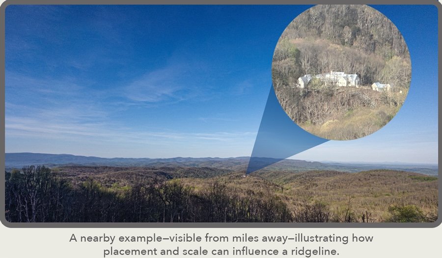 To reiterate, unlike North Carolina, Georgia has no law specifically aimed at protecting the visual integrity of its ridgelines. Existing regulations focus largely on erosion, density, and land disturbance—not what a structure looks like, how tall it rises, or whether it breaks the horizon from miles away. In practical terms, that means a determined developer, working within—or around—local zoning, could place a highly visible home or even a large-scale project on a mountain slope or near a summit.
What Theodore Roosevelt and Stephen Mather understood—perhaps better than we sometimes do today—is that the value of a landscape isn’t simply in standing on it—it’s in seeing it.
And a mountain, like a ridgeline, belongs not just to the person who owns a piece of it, but to everyone who looks out across it.
-
Comments
{name}
{comment}
-
Categories
-
Features
All comments are reviewed before publication to ensure Blue Ridge Horizon remains respectful and free of spam. Your mail Address will not be published.